Thursday, September 22, 2011

I'm done

Thanks to the overly sensitive moderators on the classicbattletech.com forums, I'm calling it quits.  This wasn't a spontaneous thing, it has been a long time coming, with reason after reason being presented to me until I finally just decided to move on, and will now spend my excess hours on something else.

If anybody knows how to code and wants to continue anything I've written shoot me an email and I'll send you the code.

Here is my latest version of cartographer:

Here is my working copy of all the planet data in excel:

Anything else your interested in I may have mentioned just shoot me an email.

I won't delete this blog, but it'll no longer be active.  I'll respond to emails or comments on here indefinately however.

Wednesday, September 21, 2011

Cartographer Update!

Just a minor update to let ya'll know I'm still alive.

I am having hell getting the hexes to work right.  My math skills suck, and I couldn't figure out a formula for getting all hexes within a specified range, and hard coded 0, 1, 2, and 3 hex radius.  This means you can create a hex grid of as little as 10 LY, or as much as 30 LY, but nothing else.  I also broke the square/offset square grids, well, deleted the code actually.  I'll re-add them once I get the hex stuff working, those 2 methods are far easier.

I do kind of have the hex stuff working though, here is a map, with 10 LY hexes, drawn dynamically (so changing ownership of a system changes that hex background color as well).  There are a few orphaned worlds around, and a few gaps where no system is within a jump.  The grey hexes are "contested", meaning 2 or more factions have a system within that hex.  I plan on making the hexes break down into smaller chunks until there is only 1 faction per hex, but its not real easy, and I'm tired :(

If anybody can help me out with a hex algorithm that'd be awesome.  Simple stuff, like take a battletech mapsheet, pick a hex, and give me a formula to determine all the hexes within a specified radius.  I don't think its that hard, but it was eluding me tonight.

I still have a *lot* of very minor bug fixes (like the app crashes when you cancel an inputbox, instead of cancelling the function, stupid easy to fix stuff) before I get this sucker launched, but it is chugging along.

A new screenshot showing the hex based influence mapping thingy:


Here is a big version, though it'll be slow off my crappy TW cable modem.  The dots on it are little black circles around the systems so I could see them while testing.  You'll be able to toggle them on/off in the release.  The black gaps are just that, areas where no system is within a jump.  However, there are uninhabited systems everywhere, 110000 of them, so you'll be able to find *some* path through there!

Oh, my algorithm for determining jump paths seems pretty decent, but its just looking for the nearest systems.  If anybody could help me out with a hex based A* that'd be great too.

I want to try to get printing to PDFs done really soon, I want to print this map out on a 44" plotter ;)

Wednesday, September 14, 2011

Cartographer!

Still working on it, the last couple days I haven't made much progress (but a LOT was made the few days before that) as I've been procrastinating on the hardest part of the code.

The hardest part IMO is getting a dynamic mapping system going.  You've seen some of my crappy versions in the past, here is a new version, with 7.5 LY squares, for 3075:


It isn't perfect, for a few reasons.  One, its only really working at all with squares, I haven't even touched the hex translation stuff yet, though honestly that shouldn't be *too* hard.  Its also not real fast, and never will be, though once you generate it I'll try to cache it so you only have to regenerate it if you modify system ownership.

But now a "bug" I see with my method.  Right now I'm taking a count of the number of systems within jump radius, and using that number to determine what faction "owns" the cell.  While it works fine in most situations, when it comes to those little arms that go off from one faction to another, it breaks completely.  This is because while there may be a system or two in say WOB Protectorate space, there isn't enough to be more than the WOB systems in range, so the world gets drawn with the wrong background.  While typing this I came up with the idea to automatically make any cell the same as any system within the cell.  There are a few exceptions with cells that have 2+ systems in them, but its looking better.  Here is a close up of the protectorate so you can see what I mean:

However, it may look better if I get my system to grid translation working correctly.  Its late, and I may be making stupid mistakes, but as you can see by some of the dots the dots/grids aren't lining up just right.

I *really* suck with geometry, even 2D stuff, this stuff is really easy math, and I need to go take me a class or two in it (even though I CLEP'ed it for my degree, I simply don't *know* it).

Now for the great news.  As soon as I finish this one little thing, this one "feature", I'll release a new version of cartographer for everybody.  The amount of new features and fixes are, well, long enough I think I'll just skip posting them ;)

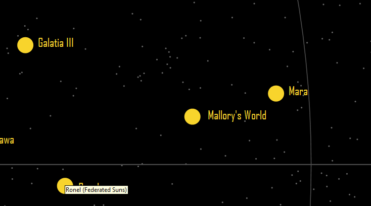
A couple of screenshots:
OMG, what is that!

See all them little bitty dots?  Remember a reference to the 110,000 uninhabited systems out there?  muhahahaha


Looking for something?  Notice I changed the font *in program* :)


Oh yeah, thats a REAL nebula image backdrop!
What kind of mad options are those?!?!?!

Uhhhh, this aint just a mapping program anymore is it?

DISCLAIMER:  The features that are in red haven't been written yet, and may not be on this next release.  Most of them are relatively easy though, and once I get the influence mapping working correctly I'll starting knocking them out within a few days (days=days coding, not actual real world days).

Btw, I'm *really* starting to kick around the idea of creating a universe, *very* similar to BT but all names/factions will change (map roughly same scale, but different systems in difference places too).  By doing this I can freely create a full game system without worrying about canon and the lack thereof.  If anybody wants to help come up with unit names, faction names, and world names, I'd be grateful, even that simple stuff is beyond my creativity.  I can do all the rest of the code though ;)

Friday, September 9, 2011

Other interesting maps

Since I had the code written to test HPG stuff... some other interesting maps:


Red = the systems that we have atmosphere, gravity, temperature, etc for:


Red=3025 systems with forces present, looks like pirates love the outback:


Systems that were on a map at some point, that are no longer on the map in 3130, RWR/OA/CC got screwed!:


Factory production line size, from the Combat Operations chart, for 3052, the green dots are there, but hard to make out, this makes sense tho:


Got any more ideas?  All I need is a list of systems and a parameter...

More HPG stuff

Ok, going through the 300 or so system we have data for appears to add about 76 new systems with A class HPGs, for a total of 124.  The map still has enough gaps that a large portion of the inner sphere simply doesn't get news except by whoever is kind enough to bring them computer updates.


It just really appears the HPG network simply isn't very effective.  I wonder if jumpships help with that, say they have a core computer that has all the "news", whenever they jump into a new system the computer automatically updates with the planet based computers, and vice versa.  This could have massive hack potential, but would be one way to help keep everybody in the sphere abreast of the latest news.


Or perhaps there are enough systems we just don't have information for, the original 48 systems were when the HPG system was only in the Hegemony really, and ComStar has since built lots of new systems.


Still, it seems silly that ComStar hasn't built 2xA stations on every planet, as that would enable an interstellar near-real time communications system.

HPG Network

So I was tinkering with the HPG network to see how it'd work.  I need to ask some more questions over at ClassicBattletech.com, but I don't think it *can* work as published.

However, I'm using the initial list of HPG A systems that I think was in the old SLDF book, but there are more A networks than that from planet data, I'll update this graph tonight.

Class A HPG stations are on 49 worlds.  These have a range of 15 pc (48.9 LY), and transmit to all surrounding B and some A stations every 24 hours.

Class B HPG stations are on all the other worlds (minus a few in the periphery).  These have a range of 9 pc, just like a jump, or 29.34 LY.  These only receive from adjacent class A stations.

Now here is the problem represented on a 3075 map:


The red circles are A networks, and all systems in that should be sending communications to the central red dot every 3 days.  Now, those A systems, or the red circles, *should* be far more spread out and always overlapping.  If they are not, there is simply no communications from Terra out past about 200 LY.  NONE, ZIP.  This means even folks on New Avalon, have to wait for a jumpship to tell them that Amaris just took over.  Ack!

Within Hegemony space however, I think all the planets are in range of an A network.  If planets could have TWO HPG A's on planet, instead of 1, then technically all of the hegemony could have real time communications as each planet could send to another planet, and receive from another planet.  Essentially a really large token ring network!

I'll post more on this later, once I have access to my data again, but I thought this was rather curious.

Monday, September 5, 2011

System Coordinates

Due to some nazi rules on the CBT forums I got banned for a week.  Not saying its a bad thing though, I waste too much time on there anyway and may try to avoid them in the future unless its to post a new program update.

Anyway, a few people have been going over the coordinate list I made a couple weeks ago.  We have found a lot of various issues, not really related to the coordinates but just systems that were renamed, duplicates, and I added all the systems on the faction creation maps that weren't in that faction.  I also updated cartographer to work with the new systems, however I think some of the last features I implemented are gone, oops :(  I'm working on a new update though.

This is a list of system names and coordinates only.  Some systems have another name and year+ in parenthesis, this means it was renamed.  Some systems have a faction code (FWL, HL, Clan, Periphery, etc) following the name in parenthesis, this represents duplicate names usually.  Some systems have "Last YYYY" in parenthesis too, this would be the last map year that system was drawn on, and sometimes it could have been renamed and reappeared later.  The first 2 lines represent the version, and whenever updated this URL will be valid.  It is about 73kb.

This file has a list of faction abbreviations (FWL=Free Worlds League), and the RGB color codes I use to represent them.  If you want to give me a new pallet of colors to use instead, I'd be very happy to use them, I just grabbed colors randomly.  The first 2 lines represent the version, and whenever updated this URL will be valid.  It is about 3kb.

This file represent the whole shebang.  It has system names, coordinates, and owners for every year we have a published map for.  The owners are comma separated list, the first element is the faction, after that it'll have things like region/march/province/etc names.  At the end of the owner there can be things like Faction Capital, Major Capital, or Minor Capital.  The first 2 lines represent the version, and whenever updated this URL will be valid.  It is about 1mb.  

This is a version of cartographer that works with these same files.  It isn't fully featured, and can be considered an "alpha" release.  There are a LOT more features I plan on implementing before the next release (see previous post), and some features (like links to sarna.net and isatlas) have been removed.  This doesn't really replace previous versions, but it does show you new coordinates and you can push F1 for help.  There is no version, and it could be updated anytime.  It is about 165k.

Let me know if these links don't work for you or you have any questions on the stuff at bad_syntax@ yahoo.com.